The greatest long-term threat to any barrier island is sea level rise. But as anyone who saw the impact Hurricane Sandy had in 2012 can tell you, year-to-year the scariest things for Fire Island are major storms, most especially hurricanes and nor’easters.
What’s the difference?
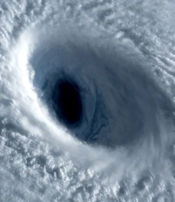
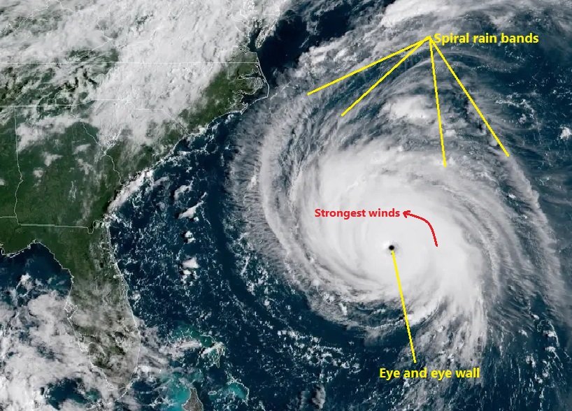
Hurricanes and nor’easters are both low-pressure weather systems with strong counter-clockwise rotation, heavy rains and powerful winds that leave substantial damage in their wakes. While both nor’easters and hurricanes share similar meteorological features, there are essential differences: Nor’easters are cold-core lows that usually form over the landmass of the continental U.S. or the gulf coast, and occur between October and April, whereas hurricanes are warm-core lows that happen between June and November.
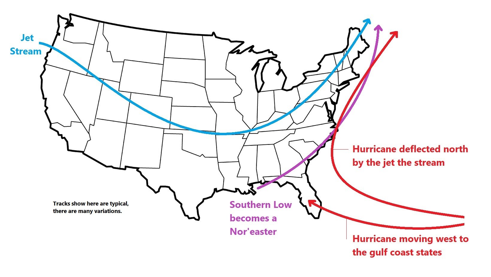
Hurricanes usually form over the eastern Atlantic Ocean, near the coast of Africa. They are born as severe thunderstorms consolidate. Tropical currents then push the storms westward, where they have six to eight days over open ocean to gain strength from warm tropical water. Consequently, by the time they arrive in the Americas, hurricanes are usually much stronger than nor’easters.

Nor’easters are stronger at higher altitudes than on the surface, so they don’t usually create warm and cold fronts, making a nor’easter a relatively simple storm. It can pick up a lot of moisture (sometimes even more than a hurricane) but they don’t grow to hurricane strength because land does not inject nearly as much energy into the storm as does the ocean. Moreover, a nor’easter is far more likely than a hurricane to be weakened by a phenomenon called wind shear.
If you’ve ever flown from coast to coast or from the U.S. to Europe you may have noticed that flying east takes about an hour less time than the return trip west. This is due to an atmospheric phenomenon called the Polar Jet Stream, which is a relatively narrow band of air (typically 20,000 feet top to bottom and 100 miles wide) that moves at speeds from 50 to 150 miles per hour. Eastbound flights intentionally hitch a ride on it. This saves time and fuel.
Storms that encounter the jet stream are disrupted by wind shear, which literally slices the top off of a storm. This weakens nor’easters much more often than hurricanes because hurricanes form far enough south that they are rarely disturbed by the jet stream until very late in their life cycle, if at all.
Winds can be strong in a nor’easter, up to 60 or 70 miles per hour, with stronger gusts. This is enough to down trees and utility poles, but the winds of a nor’easter are generally not strong enough to cause significant damage to structures or to drive a large storm surge.
Because a hurricane typically arrives in our area from the ocean, it has an opportunity to drive very large storm surges onto Fire Island. The wind can be bad, and the rain can create nasty flooding, but what makes a hurricane so destructive is the storm surge, which can flow over the island between 4 to 20 feet higher than high-tide with a force strong enough to rip buildings right off their foundations.

For example, in 2012 we saw Hurricane Sandy destroy houses in several communities from Davis Park to Robbin’s Rest in just minutes! Likewise in Ocean Beach, where homes and commercial structures were severely damaged and in the bayside downtown area the water level rose to chest height.
As Hurricane Sandy approached the police very strongly advised me to leave the island, and when they saw I was vacillating they told me in no uncertain terms that if I decided to stay I had to write my social security number on my forearm in large digits using a sharpie so they could identify my body after the storm passed. They were deadly serious. And that did it for me, I got on the second to last ferry out of here.
With wind-blown debris and heavy rain, a nor’easter can be difficult to cope with, but it’s a hurricane’s storm surge that can kill you. If you’re here when a hurricane is forecast to arrive and the authorities warn you to leave, follow their advice!


