On the night of March 13, 1657, a nor’easter blew the Dutch West India Company ship Prince Maurice off course into the coast of Fire Island. All early Dutch maps failed to record the stretch of land currently referred to as Fire Island, and the 129 passengers, including Dutch soldiers, faced uncertainty. But unlike the dozens of ships that ran aground during the 1600s and the hundreds that would be battered along the South Shore in the centuries to come, this wreck became an event that dwarfed the myth of diplomacy between settlers and indigenous people on the first Thanksgiving. With the research skills of Toya Dubin and the team at the New Amsterdam History Center, this once-forgotten story is preserved and retold for the next inquiring generations to come.
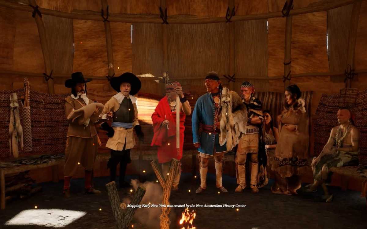
While the Dutch were stranded on the barrier beach of what is believed to be modern-day Smith’s Point, the crew had reason to be concerned. Not only did they face starvation and freezing temperatures, but also potentially vengeful indigenous people. Little over ten years prior, the Dutch hired a mercenary named John Underhill, who raised a militia to slaughter almost all the Massapequan people. The Massapequans were one of the close-knit 13 tribal settlements of Long Island. But the Peach War, which was started over the killing of indigenous women picking a peach from a well-to-do Dutch trader’s orchard, was two years prior and fresh in all local tribal members’ minds. As the crew struggled to make it to the beach, the local Unkechaug tribal members tasked with finding beached whales saw them. Reporting back to the council, the Unkechaug decided to save the crew from starvation and the elements by bringing them to their village. The council, understanding the risk to their safety, called on warriors in surrounding settlements as a safety precaution to stay in their village. Using dug-out canoes, the Unkenchaug transported the Dutch and the salvaged goods to their village at what is believed to be near Carmen’s River. A shack was erected to house the crew and the salvaged goods. The villagers fed them their limited food stored for winter, and the Dutch traded linen and duffle cloth, which was in high demand. Tensions between the two groups soon thawed. By March 12, crew member Jacob Alrichs, director of the Dutch settlement on the Delaware River, wrote a letter to New Netherlands Director Peter Stuyvesant for assistance. The letter was given to one of the indigenous people to deliver despite the potentially lethal interaction. The natives would deliver the letter to a mediator named Sara Kierstede, who had a trading post near Manhattan. In response to the request, Stuyvesant sent several trading vessels to pick up the crew.
Recreating this 367-year-old event comes with physical challenges due to the area’s accessibility because of single-family homes and endless highways now dotting the landscape. Modern-day suburbia, with its fast-paced lifestyle and miles of strip malls, is a far stretch of the imagination from the once majestic dense pine forests.
“We worked closely with Chief Harry Wallace from the Unkenchaug Nation and studied the maps,” Dubin stated, “the language of the maps, and the positions of the documented longhouses on the map, and we aligned that with Google Earth. It was a long process, but it formed an interpretation of where the shipwreck occurred and where the indigenous peoples who helped them came from. We can’t know for certain, but we have an idea where the Unkechaug Nation was located. This was achieved through virtual 3-D modeling, similar to our other project of New Amsterdam in 1660 [on display in the New York Historical Society until July]. This project will be refined for several years, and we welcome an archaeological search.”
Funding constraints limit the scope of the project. Most of the funds for the 3-D mapping came from the David Lion Gardiner Foundation. Money may be limited to recreate this event, but the story of showing mercy to someone to a party who did not necessarily return it in kind is priceless.
